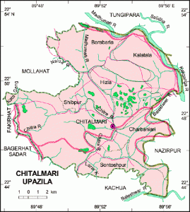
Geography
Chitalmari is located at 22°47′30″N 89°52′40″E / 22.7917°N 89.8778°E / 22.7917; 89.8778 . It has 24306 units of house hold and total area 192 km².
Demographics
As of 1991[update] Bangladesh censusTemplate:GRBangladeh, Chitalmari has a population of 127524. Males constitute are 50.78% of the population, and females 49.22%. This Upazila’s eighteen up population is 65065. Chitalmari has an average literacy rate of 37% (7+ years), and the national average of 32.4% literate.Chitalmari (Town) consists of 2 mouzas with an area of 0.89 sq km. It has a population of 973; male 53.55%, female 46.45%. The literacy rate among the town people is 52.5%.
Administration
Chitalmari thana was turned into an upazila in 1983. It consists of 7 union parishads, 51 mouzas and 121 villages.
Archaeological Heritage
Shiva temple at Durgapur (Charbaniari union).
Historical Events
During the war of liberation the Pak army in collaboration with local razakars conducted mass killing at Khalishakhali and Babuganj Bazars. They killed about 200 innocent villagers. Marks of the War of Liberation Memorial monument at Santuspur.
Population
Total population 127524; male 50.78%, female 49.22%; Muslim 60.45%, Hindu 39.35%, others 2%
Religious Institution
Mosque 184, temple 72, church 1, sacred place 3 most noted of which are Central Jami Mosque, Durgapur Temple and Boalia Durga Mandir.
Literacy and Educational Institutions
Average literacy 37%; male 42.2% and female 31.7%. Educational institutions: college 2, high school 26, madrasa 14, government primary school 63 and non-government primary school 45. Noted institutions: Charlatia Government Primary School (1904), Barabaria Hautkhola Government School (1932), S M High School (1945).
Newspapers and Periodicals
Projanma (defunct).
Cultural Organizations
Public library 1, cinema hall 1, theatre group 2, rural club 123 and playground 30.
Main Occupations
Agriculture 52.77%, fishing 1.35%, agricultural labourer 24.11%, non agricultural labourer 1.72%, commerce 8.49%, service 5.18%, others 6.38%.
Land Use
Arable land 15583.97 hectares, fallow land 3205.98 hectares; single crop 11%, double crop 49%, treble crop 40%; land under irrigation 89%.
Land control
Among the peasants 40% are landless, 29% small, 18% intermediate and 13% rich; per head arable land 0.11 hectare.
Value of Land
Market value of first grade land is Tk. 5000 per 0.01 hectare.
Main Crops
Paddy, wheat, jute, pulse, onion, chalkumra and potato.
Extinct and Nearly Extinct Crops
Tobacco, spices, jute, aman paddy.
Main Fruits
Mango, black berry, banana, coconut and betel-nut.
Livestock and Fisheries
Fisheries, dairies and potteries Fishery 11747 (shrimp), poultry 60.
Communication Facilities
Roads: pucca 15 km, semi pucca 20 km and mud road 432 km.
Traditional Tansport
Bullock cart (nearly extinct), alanquin (extinct) and country boat.
Mill & Factory
Manufactories Flour mill 8, chira mill 2, ice factory 4, rice mill 127.
Cottage Industries
Weaving 30, bamboo work 425, goldsmith 25, wood work 200, tailoring 225, blacksmith 13 and welding 10.
Hat Bazaar
Hats, bazaars and fairs Total number of hats and bazaars are 15, fairs 5, most noted of which are Shailadha Bazaar, Khager Hat and Chardakatia Baruni Mela.
Main Exports
Leather, paddy, banana, coconut, betel nut and vegetables.
NGO Activities
Gonomilan Kendra, Grans, BSS, brac, asa, CARE, CRC, Prodipan, Annesha Foundation, World Vision and grameen bank.
Health Centre
Upazila health complex 1 and family planning centre 3.