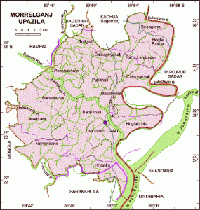
Geography
Morrelganj is located at 22°27′00″N 89°51′30″E / 22.4500°N 89.8583°E / 22.4500; 89.8583 . It has 61210 units of house hold and total area 460.91 km².
Demographics
As of the 1991 Bangladesh census, Morelgonj has a population of 321153. Males constitute are 50.48% of the population, and females 49.52%. This Upazila’s eighteen up population is 165032. Morelgonj has an average literacy rate of 49.5% (7+ years), and the national average of 32.4% literate.
Administrative
Administration Morrelganj thana was established in 1909 and was turned into an upazila in 1985. It consists of 1 municipality, 16 union parishads, 122 mouzas and 184 villages.
Archaeological Heritage
Neelkuthi (1849) and Rajbari at Bonogram.
Historical Events
During the British rule Henry Morrel established indigo factories and conducted torture in the area. In protest peasant rebellion spread under the leadership of Rahimullah of Baraikhali who was killed on 25 November 1861. Morelgonj is named after the Morrel family. During the War of Liberation 35 people were killed in an encounter between the freedom fighters and the Razakars on 15 August 1971. Mark of War of Liberation Memorial monument 1.
Religious Institutions
Mosque 618, temple 65.
Population
Total Population 321153; male 50.48% and female 49.52%; Muslim 86.59%, Hindu 13.28% and other 0.13%.
Literacy and Educational Institutions
Average literacy 49.5%; male 53.9% and female 40%. Educational institutions: college 6, high school 76, madrasa 291, most noted of which is AC Laha Pilot High School (1924).
Newspapers and Periodicals
Morrelganj Barta (fortnightly), Mojlum (periodical) and weekly Royal Bengal (defunct)
Cultural Organizations
Press club 1, theatre group 2, public library 1, opera party 1 and rural organisation 7.
Main Occupations
Agriculture 35.49%, fishing 3.65%, agricultural labourer 20.73%, wage labourer 6.85%, commerce 11.85%, transport 1.4%, service 5.6%, others 14.43%.
Land Use
Cultivable land 31778.22 hectares; single crop 73.14%, double crop 15.30% and treble crop 11.56%.
Value of Land
Market value of first grade land is Tk 2000 per 0.01 hectare.
Main Crops
Paddy, potato, brinjal, sugarcane.
Extinct and Nearly Extinct Crop
Sweet potato.
Main Fruits
Mango, blackberry, jackfruit, guava, banana, palm and coconut.
Livestock and Fisheries
Fisheries, dairies and poultries Fishery 960, poultry 13, dairy 8, hatchery 1.
Communication Facilities
Roads: pucca 59 km, semi pucca 82 km and mud road 765 km.
Traditional Transport
Palanquin (nearly extinct).
Mill & Factory
Ice factory 4, rice mill 59, saw mill 46 and welding 30.
Cottage Industries
Bamboo and cane work 144 and embroidery work 10.
Hat Bazaar
Hats, bazars and fairs Noted hats are Morrelganj, Daibogohati and Polerhat; noted fairs are Kalachand Aulia Mela, Laxmikhali Mela and Sanki Bhanga Baishakhi Mela.
Main Exports
Fish, betel nut, coconut and banana.
NGO Activities
brac, proshika, asa, grameen bank, Bima Prokalpo, Ranar Uddipan, Mashuk, Gono Shastho Kendra, Dak Deya Jai, CDC.
Health Centers
Upazila health complex 1, satellite clinic 1, health and family planning centre 16, veterinary hospital 1 and private clinic 1.